Big changes coming to busy Central Lancashire road junctions as part of plans for axed IKEA site
A raft of major changes will have to be made to some of the busiest parts of the road network in South Ribble to accommodate the new Lancashire Central development.
Watch more of our videos on Shots! and live on Freeview channel 276
Visit Shots! now[1]The industrial, retail and leisure scheme - on land at Cuerden, close to the intersection of the M6 and M65[2] motorways - was given the green light by Lancashire County Council’s development control committee earlier this month.
However, the planning permission granted came with a number of proposed highway revamps - the biggest of which are at or close to the motorway junction itself - designed to ensure surrounding routes can cope with the increase in traffic and remain safe.

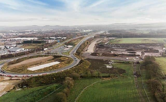
 The road network around the Lancashire Central site in Cuerden is set for a revamp (image: Lancashire County Council)
It is just over a year since National Highways - the organisation responsible for the motorway and strategic A-road network in England - put the brakes on the plans for the huge plot, which had previously been earmarked for an IKEA store.
In September 2022, the government-owned body demanded that consideration was given to the potential impact of the plans[3] on a broader set of nearby motorway junctions than had been considered in a transport assessment undertaken as part of the planning process.
However, by the time the Lancashire Central application was determined more than 12 months later, both National Highways and Lancashire County Council’s own highways department - which is responsible for all routes other than those that the former looks after - had concluded that the scheme could be “made acceptable” with the necessary road changes.
It is expected that the new vision for the site will generate fewer vehicle trips overall than previous IKEA-centred applications - but there are likely to be more HGV movements, especially on weekdays.

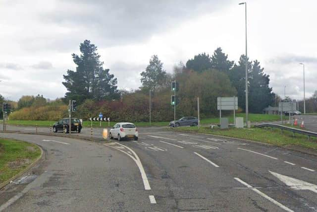
 The A6 northbound at the A582 roundabout will be widened for approaching traffic (image: Google)
Details of several of the proposed highway measures will have to be approved separately by County Hall before building work begins.
HOW WILL THE ROADS CHANGE?
***M65 terminus roundabout - separation of existing approach for motorway-bound traffic into two - one for vehicles heading for the M65 traffic and other for those wanting the M6. Traffic lights will be installed on all approaches to the roundabout, along with a new exit to the west, providing access to Lancashire Central.
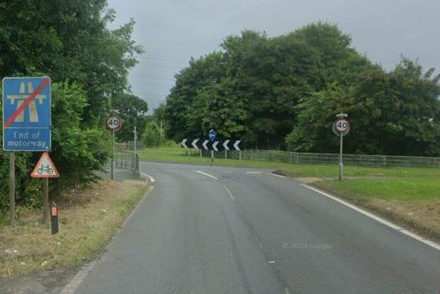
***M6 junction 29 roundabout (Bamber Bridge interchange north) - traffic lights to be installed at the end of the M6 southbound exit slip road, which will also be widened to three lanes at the approach to the roundabout. A signal crossing for pedestrians and cyclists will be introduced at the end of this slip, as well as at the start of the M6 northbound entry slip. A free- flow left turn lane from the A6 westbound to the M6 southbound will be added, along with an additional lane on the A6 eastbound approach.

 The M6 southbound exit slip road at junction 29 will get traffic lights as part of the highway mitigation measures for the new Lancashire Central development (image: Google)
***M6 junction 29 roundabout (Bamber Bridge interchange south) - traffic lights to be installed at the end of the northbound exit slip road.
***A582/A6 roundabout - widening of the A6 northbound approach to three lanes and the introduction of a fourth lane on the A6 westbound approach to the roundabout. An additional left turn lane from the A6 northbound to the A582 westbound, with the manoeuvre being brought under signal control.
***A582 - widening of westbound carriageway to three lanes between Stanifield Lane and the A6. and widening of the eastbound approach to Stanifield Lane. A signalled pedestrian and cycle crossing to be installed between Old School Lane and Todd Lane South.
***A6/Wigan Road signal junction - additional lane on A6 westbound approach and new left turn lanes for A6 eastbound and B6258 (Station Road) traffic. Existing pedestrian and cycle crossings at the junction will be retained.
***Stanifield Lane - the speed limit on the northern section of the route will be halved from 60mph to 30mph. Traffic signals to be introduced at the junction to the Lancashire Central site, along with a three-metre shared footway and cycleway to the east of Stanifield Lane.
***Stoney Lane - traffic calming measures and a new footway.
HOW WILL VEHICLES GET INTO THE LANCASHIRE CENTRAL SITE?
Three entry points are planned to the development, each accessing one of the five different zones into which the Lancashire Central plot will be split:
***from the M65 via the existing terminus roundabout;
***from Wigan Road, on the eastern boundary of the site, via a four-arm traffic-controlled
***from Stanifield Lane, on the south-western edge of the site, via a three-arm signalised junction.
Meanwhile, pedestrian and cycle access will be provided from the vehicular entry points on Wigan Road and Stanifield Lane, while a separate entrance for pedestrians and cyclists access will be introduced parallel to Old School Lane from the north.
References
- ^ Visit Shots! now (www.shotstv.com)
- ^ M65 (www.lep.co.uk)
- ^ the potential impact of the plans (www.lep.co.uk)