Glasgow historic area ‘used as rat run’ to motorways is a problem to be tackled says council
Proposals include lane changes to Bridge Street and a new junction.
15:52, 29 Apr 2026Updated 15:56, 29 Apr 2026
 View Image
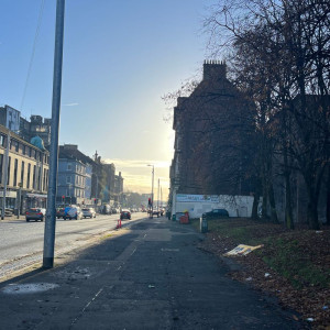
Bridge Street
The problem of historic Glasgow streets being used as a rat run to the motorways is to be tackled as part of a masterplan.
There are hopes to reduce the number of roads being clogged up with motors in North Laurieston[1] as part of a bid to make the streets more attractive and greener. Possible proposals include lane changes to Bridge Street and a new junction.
The draft North Laurieston masterplan also aims to deal with empty gap sites and help protect heritage buildings as the area has already lost the iconic India Buildings.
A council official told a committee that the masterplan aims to "bring a much more simplified road network" to increase "pedestrian and people friendly spaces".
He told councillors: "North Laurieston is bisected by the road network - effectively acting as an inner ring linking from the High Street to the M74, M8."
He added: "This results in a heavily car dominated area" which he explained is to "the detriment of pedestrian and environmental quality and connectivity across the area."
Replying to a query from councillor Ken Andrew about the M8, he said three or four roads will see more public space and be transformed into walkable usable neighbourhoods.
Speaking at last week's economy, housing, transport and regeneration committee, councillor Ruairi Kelly mentioned sometimes resident's desires for more parking clashes with calls for green, safer streets.
He said: "Denser living, livable and walkable cities, local amenities and unvetted car access are incompatible in terms of all of that being available and there will have to be compromises in many of these things."
The official mentioned the issue of the roads in the neighbourhood being part of a "rat run".
The draft North Laurieston masterplan has been developed in a partnership between Glasgow City Council and New Gorbals Housing Association and was prepared by consultants, Elder & Cannon Architects. The document will soon go out to public consultation for six weeks in May and June.
It will then go in front of the city administration committee for approval.
The vision aims to transform the district through "reconnecting North Laurieston to the city centre, Tradeston, New Gorbals and the rest of Laurieston", according to the council.
Article continues belowThe waterfront and gap sites are to be addressed and heritage buildings, street and public spaces are to be revitalised.
The is also a goal to re establish a vibrant neighbourhood on the south bank.
The council said it will "work with owners on the management and enhancement of their heritage buildings and will use statutory powers if needed to address deteriorating heritage buildings and bring them back to productive use".
References
- ^ North Laurieston (www.glasgowlive.co.uk)