Edinburgh Road rail crossing drone survey on July 25
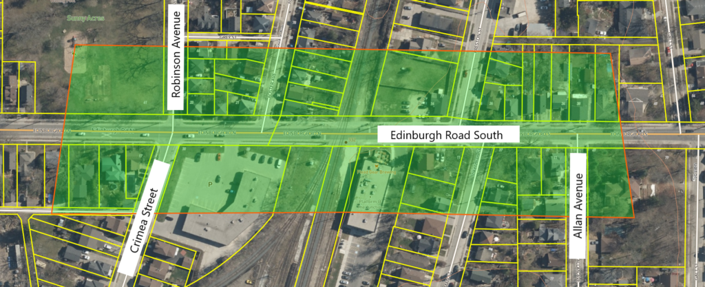
Guelph, Ont., July 22, 2024 - The City will soon collect data on the physical features of the Edinburgh Road rail crossing using a drone. The topographic survey data collection area will extend along Edinburgh Road South, from Robinson Avenue/Crimea Street to Allan Avenue. The drone will be used on or about July 25, weather permitting.
The collected data will help inform how we continue with the Schedule C Municipal Class Environmental Assessment as part of our Rail Crossing Study. The study will help determine if grade separation between the road and railway should be considered, and evaluate potential alternatives for addressing safety and traffic considerations. No private information will be collected.
The data will provide information about the ground's physical features only. The drone data is being collected by J.D. Barnes Limited on behalf of the City.
If you'd like to know more about the Rail Crossing Study, please visit guelph.ca/living/getting-around/railways-and-trains-in-guelph/metrolinx-in-guelph/rail-crossing-study/[1].
The City appreciates your patience, understanding and cooperation during this important work.
For more information
Jennifer JusteManager, Transportation PlanningCity of Guelph519-822-1260 extension 2791[email protected][2]
Map of approximate survey area