4 long-lost steam railway line walks to discover in the Highlands and …
Click here to sign up to our free newsletters![1]
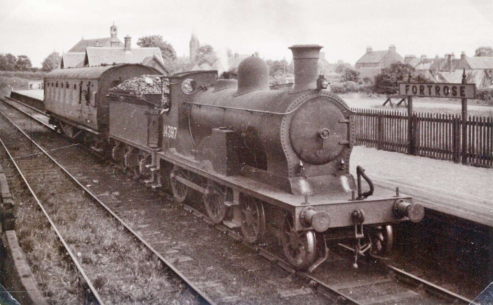
Picture: Highland Railway Society - Am Baile.
STUNNINGLY beautiful railways and the Highlands go hand-in-hand - with the likes of the West Highland and the Kyle lines world famous for good reason. Their jaw-droppingly majestic settings take rail passengers past such spellbinding sights as the Glenfinnan Viaduct, and the beautiful waters of Loch Carron. But the Highlands and Moray aren't just a railway and landscape travellers' idea of a match made in heaven - they are also home to numerous lost railways with equally beautiful scenery.
And, although these lost wonders may not have welcomed rail passengers since the days of Dr Beeching's infamous axe in the 1960s, many are still welcoming 'passengers' of the two-footed or two-wheeled variety even today. Related: Explained: The phantom Highland steam railway line that never was...[2] So, if you want to explore stunning landscapes while taking a metaphorical trip back in time to the age of steam, then you'll want to check out these stunning walks and bike rides along the region's lost railways...
Dava Way
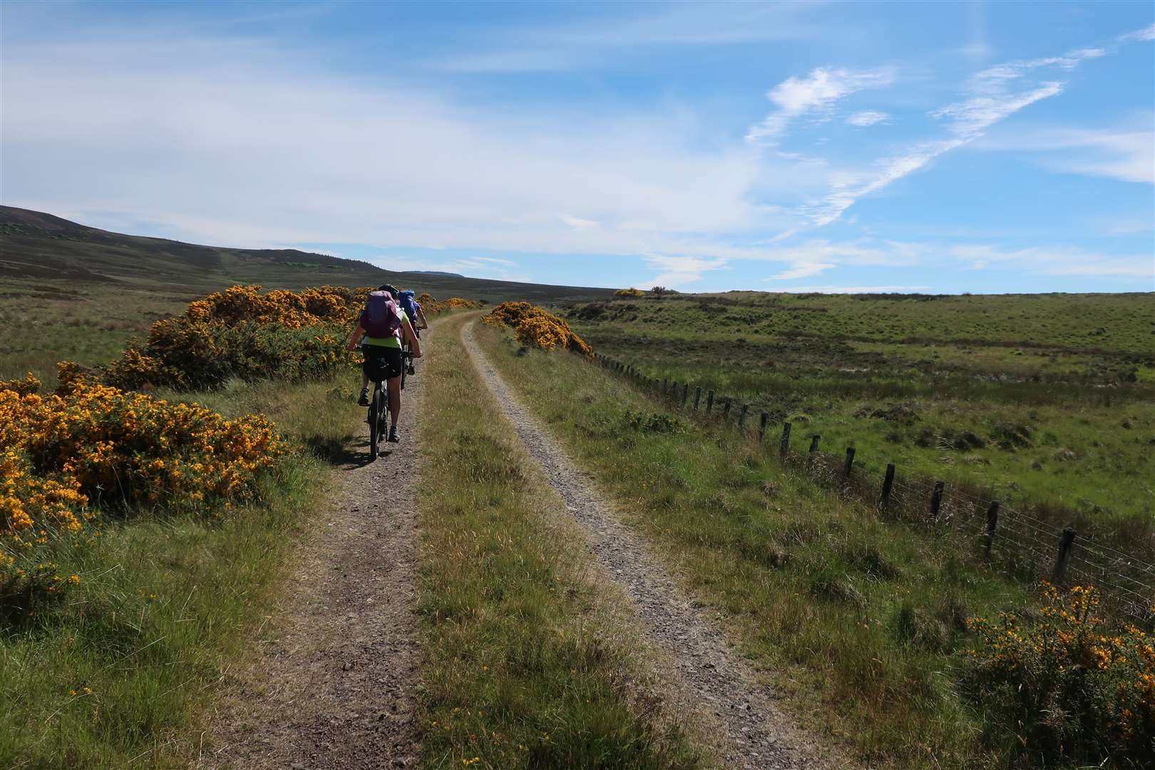
We're starting straight out the gates with one of the 'big guns' when it comes to cracking lost railway walks.
The Dava Way may be familiar to some as one of the Highlands' long-distance trails, stretching for 24 miles from Grantown-on-Spey to Forres. But it wasn't always a long-distance walk, it was once a thriving railway track bed on the old Highland Railway line - and was part of the same rail route as that used by the still surviving Strathspey Steam Railway. Today the walk makes for a tantalising target for walkers and cyclists, eager to tackle the 24-mile route on its own, or as a handy link connecting the Speyside Way with the Moray Coast Trail for an even longer outdoor adventure covering numerous days.
Click here[3] to read our Active Outdoors piece about a backpacking adventure that took in the Dava Way.
Or click here[4] to read our Active Outdoors piece about a run along the route. Cullen and Portknockie
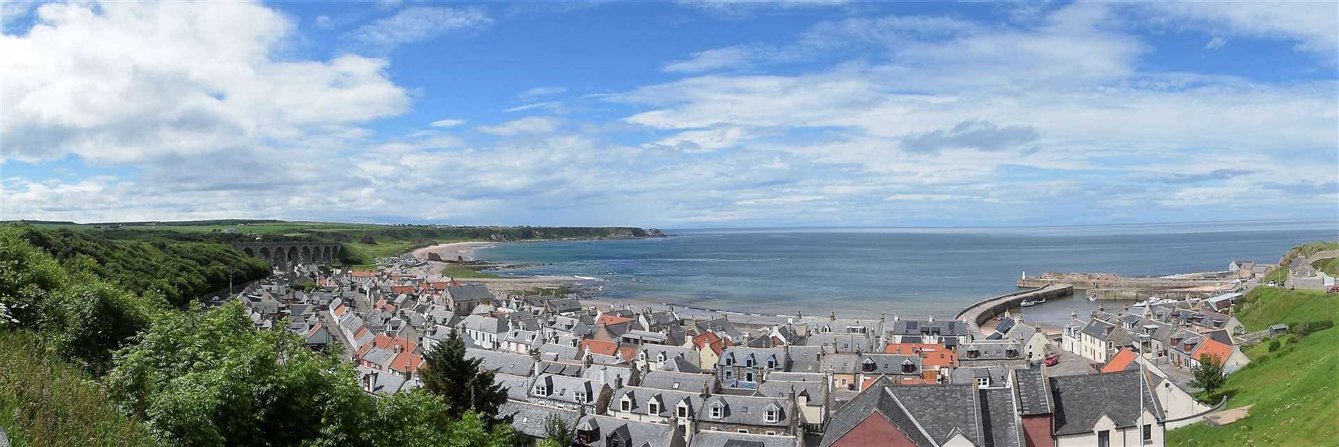
Of course, long-distance walks are not the only options available when it comes to following train routes from the age of steam. And if you crave a family-friendly walk that's a little more manageable, then the stunning circuit from Cullen to Portknockie and back is a prime example - and well worth your time.
This superb circuit begins at a seafront car park underneath the still standing railway viaduct at Cullen and then heads along the beautiful sands of Cullen Bay, before climbing up a short steep path to the headland overlooking the famous sea arch of Bow Fiddle Rock at Portknockie.
From there, turn away from the coast into Portknockie itself, and as you head south along the A942 keep your eyes peeled for a footpath sign on the left directing pedestrians and cyclists back to Cullen via a traffic-free route. This route is in fact the abandoned track bed of the former Moray Coast Railway, and it follows that route all the way back to Cullen. As well as offering stunning sea views from its elevated position it also provides enticing views along the curving route towards the railway viaducts at Cullen - which you will then actually walk across before finally descending into Cullen and returning through the charming maze of seafront houses to your original start point.
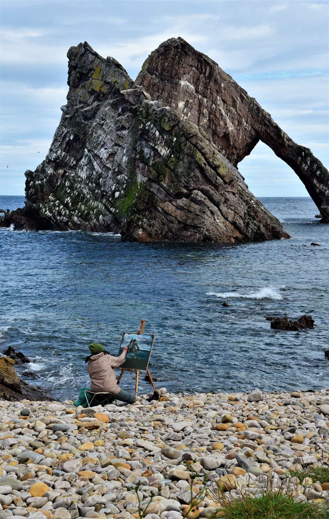
For a short four-and-a-half mile walk, this option really packs a lot in - offering everything from beautiful beaches, a stunning sea arch, equally beautiful viaducts and elevated views of Cullen and the Moray Firth.
A true gem of a walk. Click here[5] for more inspiration about Bow Fiddle Rock and other sea stacks and sea arches in the region. Avoch to Fortrose
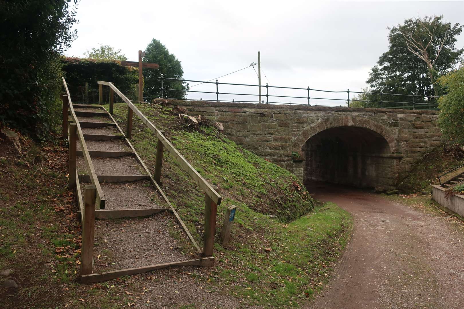
The Black Isle's former branch line between Muir of Ord and Fortrose may sadly be no more, but evidence of its past life still exists in places if you know where to look.
And, in the case of this walk, you'll find yourself following the former track bed continuously between Avoch and Fortrose. Although it offers an elevated vantage point above the Moray Firth, the old railway is lined by trees that only provide tantalising glimpses of the sea - although head in winter or autumn and the lack of foliage does open this up to some extent. Starting from the car park at the harbour in Avoch, walkers who choose to follow the old railway will need to turn up the hill at School Brae before turning onto Braehead on the right, where the old railway station once stood.
From here, follow the sign for the public footpath to Fortrose, which runs along the exact course of the old line right up to the outskirts of the village. From here you can head up through the Feddon Hill neighbourhood and onto Church Street, before heading left until you come to the turn-off for the Knockmuir road. This elevated minor road offers stunning views across the Moray Firth as you make your way back to Avoch, before descending steeply downhill back into the village and on to the harbour car park where you started your walk.
And, if you'd rather walk a little further, then there's a longer version loop available, which we have covered in Active Outdoors. Click here to read the guide for that route[6]. Peffery Way

One of the newest additions to this list, the Peffery Way follows the route of the former branch spur that peeled off from the Kyle Line near Dingwall and used to head into the spa resort of Strathpeffer. Community-spirited volunteers have spent years gradually bringing the former line back into use as an off-road path and cycle way linking Strathpeffer with Ross-shire's county town.
The Way itself is roughly 5-6km long and offers a straight-forward linear walk or cycle, but can also be used as a jumping off point for other walks in the area around Strathpeffer, such as the path that climbs up to the ancient hill fort of Knockfarrel. Should you opt for this, you'll enjoy some superb elevated views of the surrounding area - including the mountains of Ross-shire, as well as back towards Dingwall and the Cromarty Firth. And, if you'd rather stick to lower levels, you can always opt instead for short walk to the village's Touchstone Maze before returning back into the heart of Strathpeffer via the way you came and then retrace your steps along the Peffery Way.
Click here[7] for our Active Outdoors piece about the Peffery Way. As well as these four options, there are many more enticing former railway walks waiting to be discovered - be they sections of the Speyside Way, a coastal walk to Embo in Sutherland which follows the former Dornoch branch line for a part of the route, or the striking bridge across the Spey at Garmouth near the river's mouth. What railway relic will you choose to explore?
And keep your eyes peeled here soon for more long lost Highland and Moray lines you can still explore on foot or by bike.
Do you want to respond to this article?
If so, click here[8] to submit your thoughts and they may be published in print.
References
- ^ Click here to sign up to our free newsletters! (www.inverness-courier.co.uk)
- ^ Explained: The phantom Highland steam railway line that never was... (www.inverness-courier.co.uk)
- ^ Click here (www.inverness-courier.co.uk)
- ^ click here (www.inverness-courier.co.uk)
- ^ Click here (www.inverness-courier.co.uk)
- ^ Click here to read the guide for that route (www.inverness-courier.co.uk)
- ^ Click here (www.inverness-courier.co.uk)
- ^ here (www.inverness-courier.co.uk)