More rain in the forecast to keep an eye on after Storm Babet’s torrents
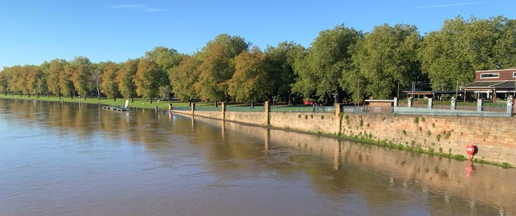
There will be more rain this week. Not the torrents of Storm Babet but still, unwelcome rain for the flood-hit areas and unneeded rain on already saturated ground.
There is a yellow warning[1] for rain today from the UK Met Office over eastern England, covering the Humber, East Midlands and some of Yorkshire. The river impacts could continue into Wednesday here. There will also be heavy rain for southern counties of England and Wales later today with heavy showers for southwest England which could cause some surface water issues this afternoon. Later this week more rain is forecast for the UK with concerns for NE Britain due to the existing ground conditions.

Env. Agency ‘River flooding continues for parts of Nottinghamshire until Friday. River flooding will also continue along the River Severn until Wednesday.’ There is rain across Norfolk, the Wash across to Sheffield, Derby and Chesterfield this morning. Outbreaks of rain will continue for northern England at lunchtime but fade from the far north and become more focused on the warning area this afternoon.The Environment Agencies are reminding people to take care by swollen rivers, that there will be strong currents and that river banks or pathways could be unstable or just slippery. People should not drive through flood waters, again because currents could still be strong and move the car, or you get stranded, that the car may start to float or that the road structure has been impacted, as seen in Marykirk.
There are not any flood warnings or alerts currently in Scotland[2] but the rain later this week will not help those trying to dry out houses and businesses or the ongoing repair work along major road and rail routes, including the A90 and trains from Inverness, west and north.Natural Resources Wales[3] still has a few flood alerts in place and a flood warning for the River Dee near Wrexham, near the A483 and A534
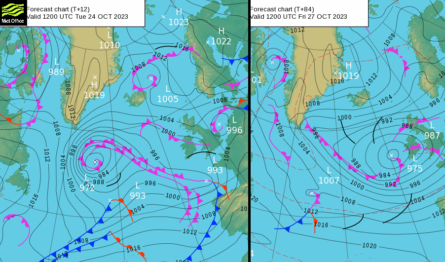
There is a rather messy synoptic picture for Tuesday with an easterly flow over the northern half of the UK and a small low centre edging up the North Sea. Another low pressure will head towards France from the Bay of Biscay throwing heavy showers over southern England and the Channel this evening and overnight. These work their way eastwards by Wednesday morning but there will be more rain for France which has also seen storm weather and devastating flooding.
As the showery rain clears SE England on Wednesday morning there will be drier conditions for much of Wales, England and Northern Ireland with sunshine around the Irish Sea in the morning. The easterly flow will bring low cloud and rain to Scotland on Wednesday. There will be a few heavier bursts in the damp conditions and these will reach across to Glasgow by the afternoon. There looks to be some heavier showers through the Central Belt on Wednesday night as other bands of showery rain reach into Ireland on Wednesday evening.
Next, a larger Atlantic low pressure begins to dominate our UK weather. It settles to the west of Ireland for the rest of the week, with its weather fronts moving over the UK and will pull an easterly flow off the North Sea. Southwestern Britain and southern Ireland will regain a southwesterly flow later this week but a secondary low will need watching. It could pull up towards Cornwall on Saturday evening bringing wet and windy weather which could reach more of the UK by Sunday if that low moves over Britain.
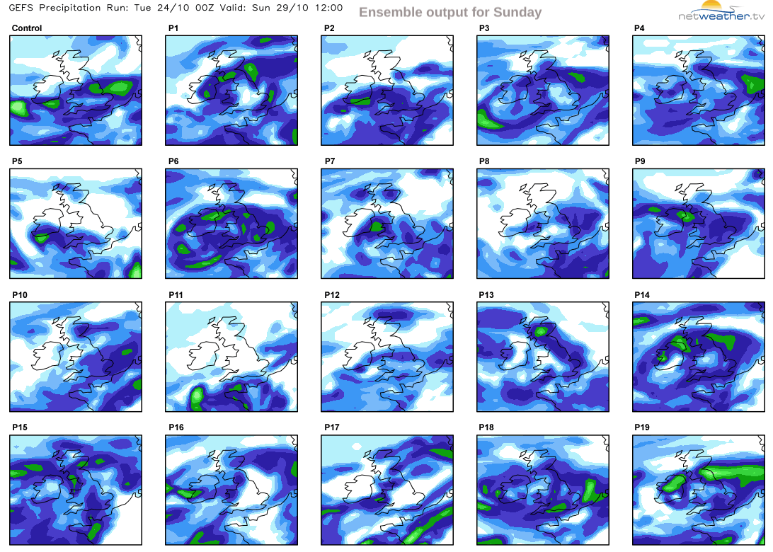
The heavier rain may not reach the severely hit flooded parts of eastern Scotland but it is worth looking at the ensemble forecast’s various solutions over the weekend.
The control forecast is produced with the best available data and unperturbed models. The others are each produced with slight perturbations of initial conditions and of the models. “Taken together the forecasts become the ensemble, which shows the range of possible outcomes and the likelihood of their occurrence.” ECMWF
Rather than showing one solution (a most likely, deterministic forecast), there is a range of forecasts, an ensemble.

Angus saw five severe flood warnings in Storm Babet and although most of the solutions keep the rainfall at low levels, some solutions show heavier rain in the region.
The latter part of this week looks unsettled with bands of heavy showers swirling around a low pressure. There could be strong winds at times, just autumnal weather but it is the existing conditions that need considering with more rain on the way.
References
- ^ yellow warning (www.metoffice.gov.uk)
- ^ Scotland (scottishfloodforecast.sepa.org.uk)
- ^ Natural Resources Wales (flood-warning.naturalresources.wales)